Introduction: A Catastrophe in the Himalayas
The Nepal–Tibet floods of August 2026 have created a major humanitarian and environmental disaster across one of the world's most difficult terrains.
The event began on August 26, when a massive high-altitude collapse involving rock, ice and glacier material triggered an extraordinary chain of events in the Himalayan border region between Nepal and China's Tibet Autonomous Region.
Floodwaters and debris moved rapidly downstream, destroying infrastructure and cutting off communities that are often separated from major cities by steep mountain roads.
The disaster has affected both local communities and foreign nationals travelling through the region, including people using routes connected to Tibet and the Kailash Manasarovar pilgrimage corridor.
By August 29, Nepal's government reported that 626 bodies had been recovered and approximately 2,400 people remained unaccounted for. Separate Chinese figures for Tibet added hundreds more missing people, pushing the combined number of people reported missing across the two sides of the border above 3,000 according to subsequent reporting.
Because rescue operations are still continuing, casualty and missing-person figures remain subject to change.
The disaster is also scientifically important.
It demonstrates how several Himalayan hazards can interact: unstable glaciers, rockfalls, landslides, temporary water storage, debris flows and extreme flooding.
Understanding that chain is essential for determining what happened, why the damage was so severe and how similar disasters could potentially be prevented in the future.
When Did the Nepal–Tibet Floods Happen?
The main disaster occurred on August 26, 2026, along the Nepal–China border and surrounding Himalayan river systems.
The most severely affected areas included sections of the Bhote Koshi and Lhende Khola river systems and communities around the Rasuwagadhi and Gyirong border areas.
Nepal's Ministry of Foreign Affairs confirmed that severe flash flooding struck the Bhote Koshi River area on August 26, causing extensive damage to homes, roads, bridges, hydropower facilities and other infrastructure.
The government immediately mobilized security forces, disaster-management agencies, medical teams and local authorities for search, rescue and evacuation operations.
However, the physical geography of the region made the emergency extremely difficult to manage.
What Happened in the Himalayas?
The disaster was not simply an ordinary river flood.
Available evidence indicates that a large high-altitude collapse initiated a rapidly developing sequence of hazards.
A mass of rock and ice moved down a steep Himalayan slope and interacted with glacier and river systems.
The resulting impact generated enormous quantities of debris and water that entered downstream channels.
Once the material reached the river system, the flow became far more destructive than a conventional increase in rainfall-driven river discharge.
Water mixed with mud, rocks, ice and other debris.
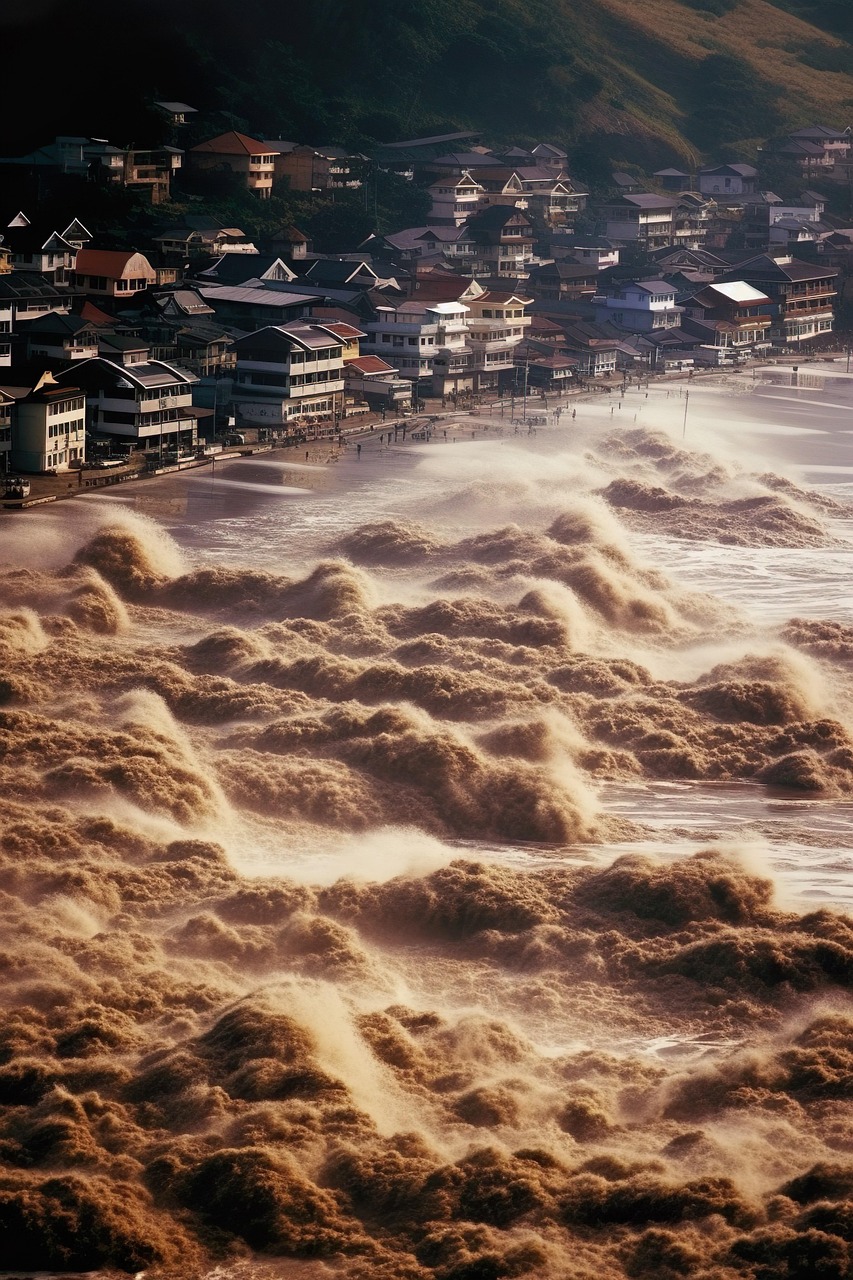
This produced a powerful debris-laden flood capable of destroying bridges, buildings, roads and other infrastructure.
Satellite observations and preliminary scientific assessments have helped researchers reconstruct parts of the sequence, but some details remain uncertain.
Was the Flood Caused by a Glacier Collapse?
Evidence strongly indicates that glacier and ice instability played an important role in the disaster.
However, it is important to distinguish between what has been observed and what scientists are still investigating.
Initial reports described a major collapse involving rock and ice that entered the river system.
Other scientific interpretations suggest that the collapse may have created or interacted with temporary water storage before a sudden release intensified downstream flooding.
Researchers are still examining exactly where the enormous volume of water originated and how the different stages of the event were connected.
Therefore, describing the disaster simply as a conventional glacier lake outburst flood may oversimplify what happened.
The event appears to have involved a combination of high-altitude slope failure, glacier instability, water accumulation and rapid downstream flow.
The Possible Chain Reaction Behind the Disaster
A useful way to understand the event is as a chain reaction.
First, a high-altitude slope became unstable.
Second, a large mass of rock and ice collapsed.
Third, the collapsing material interacted with glacier and water systems.
Fourth, enormous quantities of debris and water entered downstream channels.
Fifth, the flood moved rapidly through narrow Himalayan valleys.
Finally, settlements and infrastructure located close to the river corridors were overwhelmed.
Each stage amplified the effects of the previous stage.
This is one reason why high-mountain disasters can become catastrophic within minutes.
Why Was the Flood So Destructive?
The Himalayas are characterized by steep slopes, narrow valleys and rivers that can rapidly change their flow conditions.
When a large quantity of water suddenly enters such a system, there may be very little time for downstream communities to respond.
The presence of rocks, mud and ice makes the flood even more destructive.
Instead of behaving like clean water, the flow becomes a moving mixture of heavy sediment and debris.
Large boulders can destroy structures.
Floating vehicles and trees can become additional hazards.
Bridges can be blocked or swept away.
Roads can disappear beneath sediment.
Hydropower infrastructure can be severely damaged.
The result can be both a flood and a landslide-like debris disaster at the same time.
Where Did the Nepal–Tibet Floods Cause the Most Damage?
Some of the most severe destruction occurred around river corridors and border infrastructure connecting Nepal with Tibet.
The Rasuwagadhi area was particularly important because it is a major border and transportation zone.
On the Tibetan side, Gyirong County and the Gyirong border area suffered severe impacts.
On the Nepalese side, settlements and infrastructure along the Bhote Koshi and related river systems were heavily affected.
Roads and bridges were damaged or destroyed.
Hydropower projects were hit.
Homes and commercial structures were swept away.
Border facilities were also damaged.
What Is the Bhote Koshi River?
The Bhote Koshi is a major Himalayan river system in northern Nepal.
It flows through steep mountainous terrain and forms part of the broader river network connected to the Tibetan plateau.
The river corridor is economically important because it supports communities, transportation routes and hydropower infrastructure.
Its steep gradient also means that sudden changes in upstream water and debris conditions can move downstream rapidly.
This geographic characteristic contributed to the severity of the 2026 disaster.
What Is the Lhende Khola?
The Lhende Khola is a Himalayan watercourse connected to the broader Bhote Koshi river system.
The disaster sequence around this river system became one of the central areas of scientific investigation after the August 26 event.
Satellite imagery and ground observations are being used to determine how landslides, glacier material and water interacted before the flood reached populated areas.
Understanding these connections is important because future monitoring systems will need to watch not only rivers but also unstable slopes and glaciers above them.
Why Are Thousands of People Still Missing?
The extraordinarily high missing-person figure is one of the most difficult aspects of the disaster.
There are several reasons why identifying missing people after a Himalayan flash flood can be extremely difficult.
First, floodwaters moved through narrow valleys with enormous force.
People and vehicles may have been carried far downstream.
Second, entire buildings and sections of settlements were destroyed.
Third, roads and bridges were damaged, preventing rescuers from reaching some areas quickly.
Fourth, communications infrastructure was disrupted.
Fifth, many people were travelling through the region, making it difficult to immediately establish accurate passenger and visitor lists.
Finally, bodies may have been buried beneath mud, debris or collapsed structures.
Why Is It Difficult to Count the Missing?
Missing-person numbers during a disaster are not the same as confirmed death counts.
A person can initially be reported missing and later be found alive.
Others may be located in hospitals or evacuation centers without their families immediately knowing.
In remote areas, communication failures can delay confirmation.
Foreign tourists and workers can also be difficult to track when travel records are incomplete or when people are separated from their groups.
For this reason, authorities continue to revise casualty and missing-person lists as information becomes available.
Nepal's Ministry of Foreign Affairs has repeatedly emphasized that the figures remain subject to verification as search-and-rescue operations continue.
How Many People Have Died?
The death toll has risen rapidly since August 26.
Nepal's official figures changed substantially as bodies were recovered from river corridors and debris fields.
On August 29, Nepal's Ministry of Foreign Affairs reported that 626 bodies had been recovered.
Later reports from international news agencies placed the combined death toll in Nepal and Tibet at more than 690.
These figures should be treated as developing rather than final because search operations remain active.
The final toll could change significantly as rescuers reach areas that remain inaccessible.
How Many People Are Missing?
According to Nepal's August 29 official update, approximately 2,400 people remained unaccounted for.
Chinese authorities separately reported hundreds of missing people in Tibet.
International reporting subsequently placed the combined number of missing people across Nepal and Tibet above 3,000.
The missing include local residents, workers and foreign nationals.
Because different authorities use different reporting times and verification systems, the numbers should not be treated as permanently fixed.
Foreign Nationals Are Among the Missing
The disaster affected an international population as well as local communities.
The Himalayan border region is used by tourists, pilgrims, traders, workers and travelers heading toward Tibet.
Nepal's official updates reported people from dozens of countries among those affected or reported missing.
Chinese authorities later identified missing foreign nationals from numerous countries on the Tibetan side.
This international dimension has resulted in governments contacting Nepal and China to locate their citizens.
It has also increased pressure for rapid identification and communication during the rescue operation.
Did an Earthquake Cause the Nepal Floods?
There have been reports and scientific discussions about seismic activity associated with the initial collapse.
However, the presence of seismic signals does not automatically mean that a conventional earthquake was the primary cause of the disaster.
A massive landslide or rock-and-ice collapse can itself generate seismic signals.
Researchers are therefore examining whether an earthquake initiated the collapse or whether ground motion was primarily a consequence of the enormous mass movement.
This distinction is important.
The exact trigger remains an area of active scientific investigation.
What Role Did Climate Change Play?
Climate change is an important part of the scientific discussion surrounding the disaster, but it should not be presented as a single proven cause of every individual collapse.
The Hindu Kush Himalaya region is warming rapidly.
Higher temperatures can contribute to glacier retreat, changes in snow conditions, permafrost degradation and destabilization of high-altitude slopes.
These changes can increase the probability of some types of glacier-related hazards.
Scientists have warned that a warmer Himalayan environment can create increasingly unstable conditions involving ice, rock and water.
That does not mean every landslide is directly caused by climate change.
Instead, climate change can alter the background conditions in which individual disasters occur.
Why the Himalayas Are Becoming a Major Climate Risk Zone
The Himalayas contain thousands of glaciers that feed rivers supporting enormous populations across Asia.
These glaciers are sensitive to temperature changes.
As the climate warms, glacier retreat can change the geometry of mountain slopes and increase the formation or expansion of glacial lakes.
Permafrost at high elevations can also weaken as temperatures rise.
When ice that previously helped stabilize rock disappears, slopes can become more susceptible to collapse.
This creates a complex relationship between climate change and mountain hazards.
What Is a Glacial Lake Outburst Flood?
A glacial lake outburst flood, commonly called a GLOF, occurs when water stored in or near a glacier is suddenly released.
The release can occur because of an ice avalanche, landslide, earthquake, dam failure or other disturbance.
Once released, the water can travel rapidly downstream.
GLOFs are particularly dangerous in steep mountain valleys because the water can gain destructive momentum while carrying enormous quantities of sediment and debris.
The 2026 Nepal–Tibet event appears to have involved glacier and landslide processes, but researchers are still determining whether the event fits a conventional GLOF classification or represents a more complicated compound hazard.
Why Temporary Lakes Are Dangerous
A landslide can temporarily block a river and create a natural dam.
Water then accumulates behind the barrier.
If the barrier fails, the stored water can be released suddenly.
This creates a flood wave that may be far larger than the river's normal discharge.
In a mountainous region, such temporary lakes can appear and disappear rapidly.
That makes remote monitoring extremely important.
Are More Floods Possible?
Authorities have continued monitoring river levels and unstable areas following the initial disaster.
Chinese authorities also reported that the immediate risk from one newly formed lake near the border had declined as the lake began draining.
However, another larger lake was identified upstream, meaning the region could not simply be considered safe after the first flood wave passed.
Officials have used drones, satellite imagery and other monitoring tools to watch water levels and unstable terrain.
Continued rainfall could increase downstream risks.
Why Rescue Operations Are So Difficult
Search and rescue teams are operating under extraordinary conditions.
The Himalayan terrain is steep and unstable.
Roads have been destroyed.
Bridges have disappeared.
Some areas can only be reached by helicopter or through difficult mountain routes.
Weather conditions can also prevent helicopters from flying.
Flood sediment makes tunnels and buildings difficult to enter.
Rescuers therefore face a combination of natural hazards and infrastructure failure.
Hydropower Workers Are Among Those Missing
The affected river corridors contain major hydropower infrastructure.
Some workers were inside facilities or tunnels when floodwaters and debris struck.
This created particularly difficult rescue conditions.
Reports have described rescue teams searching hydropower tunnels and using specialized equipment to determine whether trapped workers remain alive.
The situation illustrates another important issue: Himalayan economic development is increasingly placing infrastructure in valleys that are also exposed to natural hazards.
Why Roads and Bridges Matter So Much
In mountainous Nepal, roads and bridges are more than transportation infrastructure.
They determine whether emergency teams can reach isolated communities.
When a flood destroys a bridge, an entire valley can become effectively cut off.
That can delay medical treatment, food deliveries and evacuation.
Rebuilding transportation infrastructure therefore becomes part of the emergency response itself.
How Many People Have Been Rescued?
Thousands of people have been rescued or evacuated since the disaster began.
International reporting on August 29 indicated that more than 3,700 people had been rescued in Nepal.
Helicopters have been particularly important for reaching communities cut off by destroyed roads.
Relief centers have also been established to provide food, medical assistance and temporary shelter.
However, rescue numbers do not mean that the emergency is over.
Search operations for missing people continue while survivors face the difficult transition from immediate rescue to long-term recovery.
What Is Happening With International Aid?
Nepal has sought technical and humanitarian support from the international community.
India, China, Japan, Australia and other countries have offered assistance or deployed teams and resources.
International support is particularly important for specialized rescue operations, infrastructure assessment, medical care, communications and the identification of missing people.
Nepal has also emphasized that the immediate priority is saving lives and supporting search, rescue and relief operations.
Why DNA Identification May Be Necessary
Large disasters create difficult identification problems.
When bodies are recovered after being exposed to water, mud and environmental conditions, visual identification can become difficult or impossible.
DNA testing may therefore be required to identify victims accurately.
This process can take time because investigators must collect samples, establish family reference information and process the laboratory results.
For families waiting for information, this can make an already devastating situation even more difficult.
What Happens to the Economy After the Flood?
The economic consequences will extend far beyond the immediate cost of emergency response.
Roads, bridges, hydropower facilities, homes, businesses and agricultural land have been damaged.
Tourism and pilgrimage activity can also be disrupted.
Border trade may suffer if transportation infrastructure remains damaged.
Power generation can be affected when hydropower facilities are damaged.
Reconstruction may therefore take years rather than months.
Why the Disaster Matters Beyond Nepal
The event has implications for the entire Himalayan region.
The Himalayas connect the environmental systems of Nepal, Tibet, India, Bhutan and other parts of Asia.
Rivers cross national boundaries.
Climate-driven changes at high altitude can therefore create risks far beyond the location of the original glacier or landslide.
Better regional cooperation will become increasingly important as mountain hazards become more difficult to predict.
Could a Similar Disaster Happen Again?
Yes.
The underlying geological and climatic conditions that produce Himalayan hazards will continue to exist.
Glaciers will continue to retreat and change.
Rock slopes will continue to experience instability.
Heavy rainfall will continue to produce floods and landslides.
The objective cannot be to eliminate natural hazards.
The objective is to reduce the number of people and critical infrastructure exposed to them and to provide enough warning for evacuation.
What Early Warning Systems Can Do
Early warning systems can monitor river levels, rainfall, glacial lakes, seismic activity and changes in mountain slopes.
Satellite observations can identify changes that are difficult to detect from the ground.
Drones can provide detailed information after a suspected collapse.
River sensors can detect sudden changes in water levels.
Emergency communication systems can distribute warnings to communities downstream.
The most effective system combines these technologies rather than relying on one signal.
Why Satellite Monitoring Is Becoming More Important
Many of the most dangerous Himalayan areas are remote and difficult for scientists to visit regularly.
Satellites can observe these areas repeatedly.
They can detect changes in glacier size, lake area, landslide scars and river channels.
After the 2026 disaster, satellite imagery has already played an important role in reconstructing the sequence of events.
In the future, automated satellite analysis could help identify potentially dangerous changes before a major collapse occurs.
What Nepal and China May Need to Change
The disaster highlights the need for stronger cross-border hazard monitoring.
Because rivers and glaciers do not respect political boundaries, information collected on one side of the border can be critical to communities on the other side.
Real-time sharing of river levels, glacial lake measurements, satellite observations and emergency warnings could improve response times.
Joint scientific research could also improve understanding of high-altitude hazards.
The Importance of Better Himalayan Hydrological Data
One of the challenges in Himalayan disaster management is the lack of consistent real-time information across remote areas.
Without reliable data, authorities may have only minutes to respond to a rapidly changing river.
Improved monitoring stations could provide continuous measurements.
Combining these measurements with satellite data and weather forecasts could create more accurate flood-risk models.
Should Infrastructure Be Built Differently?
The 2026 floods also raise questions about where infrastructure should be located.
Hydropower projects are naturally attracted to steep river valleys because of their energy potential.
Roads and settlements also tend to follow river corridors because mountains leave limited flat land.
But those same locations can be exposed to flash floods, landslides and debris flows.
Future infrastructure planning will need to account for changing hazard conditions rather than relying only on historical flood records.
Why Historical Flood Data May No Longer Be Enough
Climate change can alter the frequency and intensity of environmental hazards.
If infrastructure is designed only around historical conditions, future extremes may exceed those assumptions.
This does not mean every future flood will be larger.
It means risk assessments must consider changing environmental conditions.
Engineers and planners may need to use climate projections, updated glacier maps and advanced hazard models when designing infrastructure.
What Happens Next in the Rescue Operation?
The immediate priority is locating survivors and recovering people who remain missing.
Search teams will continue working around river corridors, collapsed structures, tunnels and isolated communities.
Helicopters will remain important where roads are destroyed.
Engineers will need to inspect damaged bridges and roads before they can safely be reopened.
Medical teams will continue treating injured survivors.
Authorities will also need to provide food, water, shelter and sanitation for displaced communities.
What Happens After Search and Rescue?
Once the immediate rescue phase ends, the disaster will enter a much longer recovery phase.
Families will need assistance.
Homes will need to be rebuilt.
Roads and bridges will need reconstruction.
Hydropower facilities will require engineering inspections.
Schools and healthcare facilities will need to reopen.
Communities will also need psychological and social support after losing relatives, homes and livelihoods.
Will Tourism Recover?
Tourism and pilgrimage routes affected by the disaster may require substantial time to recover.
The region is important for trekkers, pilgrims and cross-border travelers.
Safety concerns could reduce tourism even after physical infrastructure is restored.
Authorities will therefore need to demonstrate that routes, bridges, roads and warning systems are safe before reopening them fully.
What the Nepal–Tibet Disaster Teaches the World
The disaster demonstrates that modern climate risk is increasingly about compound events.
A single hazard may not cause catastrophic damage on its own.
But a glacier collapse combined with a landslide, temporary water storage, debris flow and flood can create a much larger disaster.
This means emergency planning must consider interconnected hazards rather than treating floods, landslides and glacier events as completely separate problems.
Climate Change Is Increasing the Stakes in the Himalayas
The Himalayas are undergoing rapid environmental change.
Glaciers are retreating in many areas.
Snow patterns are changing.
Permafrost is becoming more vulnerable.
Extreme rainfall events can also produce sudden flooding and landslides.
These trends do not mean that climate change directly caused every individual disaster.
Instead, they indicate that the background conditions affecting mountain stability are changing.
Why Nepal Faces a Disproportionate Risk
Nepal contributes only a small share of global greenhouse gas emissions but is highly exposed to the effects of climate change.
Its geography places communities directly below some of the world's highest and most unstable mountains.
Many communities also have limited access to advanced infrastructure and emergency services.
This creates a major climate justice challenge.
Countries with relatively low historical emissions can experience severe consequences from changes occurring across the global climate system.
Could Technology Reduce Future Disaster Deaths?
Technology cannot stop glaciers from changing or mountains from collapsing.
It can, however, improve detection and response.
Artificial intelligence can analyze satellite imagery.
Remote sensors can monitor rivers.
Drones can inspect dangerous areas without immediately exposing rescue teams.
Digital communication systems can distribute warnings.
Advanced weather and hydrological models can estimate downstream risks.
The challenge is connecting these technologies to communities quickly enough for warnings to become useful.
Why Community Preparedness Matters
Technology is only effective if people know how to respond.
Communities living near high-risk rivers need clear evacuation routes.
They need designated safe locations.
Warning messages must be understandable and accessible.
Regular emergency drills can reduce confusion during an actual event.
Local knowledge should also be incorporated into disaster planning because residents often understand the terrain better than outside agencies.
What the Final Investigation Needs to Determine
Scientists will need to establish the exact sequence of events.
Important questions include where the initial collapse occurred, how much rock and ice moved, how much water was released, whether temporary lakes formed, whether seismic activity contributed to the collapse and how the flood wave changed as it moved downstream.
Researchers will also need to determine how much climate-related warming contributed to the conditions that made the slope or glacier unstable.
These answers will be important for predicting future hazards.
Conclusion: Nepal–Tibet Floods 2026 Could Become a Warning for the Himalayas
The Nepal–Tibet floods of August 2026 were not simply a case of heavy rain causing a conventional river flood.
The evidence points toward a complex chain of high-altitude processes involving rock, ice, glacier instability, water and rapidly moving debris.
The resulting flood destroyed communities and infrastructure along the Nepal–China border and left thousands of people missing.
The disaster is still developing, and the final death toll and economic cost will take time to establish.
What is already clear is that the Himalayas are entering an era in which glacier, landslide and flood risks must be considered together.
Climate change is altering the environmental conditions of the region, while growing populations, hydropower development, transportation networks and tourism are increasing exposure to mountain hazards.
The answer is not to abandon the Himalayas.
It is to build smarter monitoring systems, improve cross-border information sharing, strengthen early-warning networks and ensure that critical infrastructure is designed for a changing climate.
The most important lesson from the Nepal–Tibet floods is therefore not only what happened on August 26, 2026.
It is what the disaster reveals about the future.
A warming and rapidly changing Himalayan environment demands a new generation of disaster preparedness—one that combines satellite monitoring, glacier science, hydrological data, engineering, emergency planning and local community knowledge.
For the families still waiting for news of missing relatives, the immediate priority remains rescue and identification.
For governments and scientists, the longer-term priority is understanding precisely why this disaster happened and making sure that the next warning comes early enough to save lives.